| << Chapter < Page | Chapter >> Page > |
GEOGRAPHY
Grade 5
MAP WORK
Module 6
SCALE AND DISTANCE CALCULATIONS
1. Scale and distance calculations
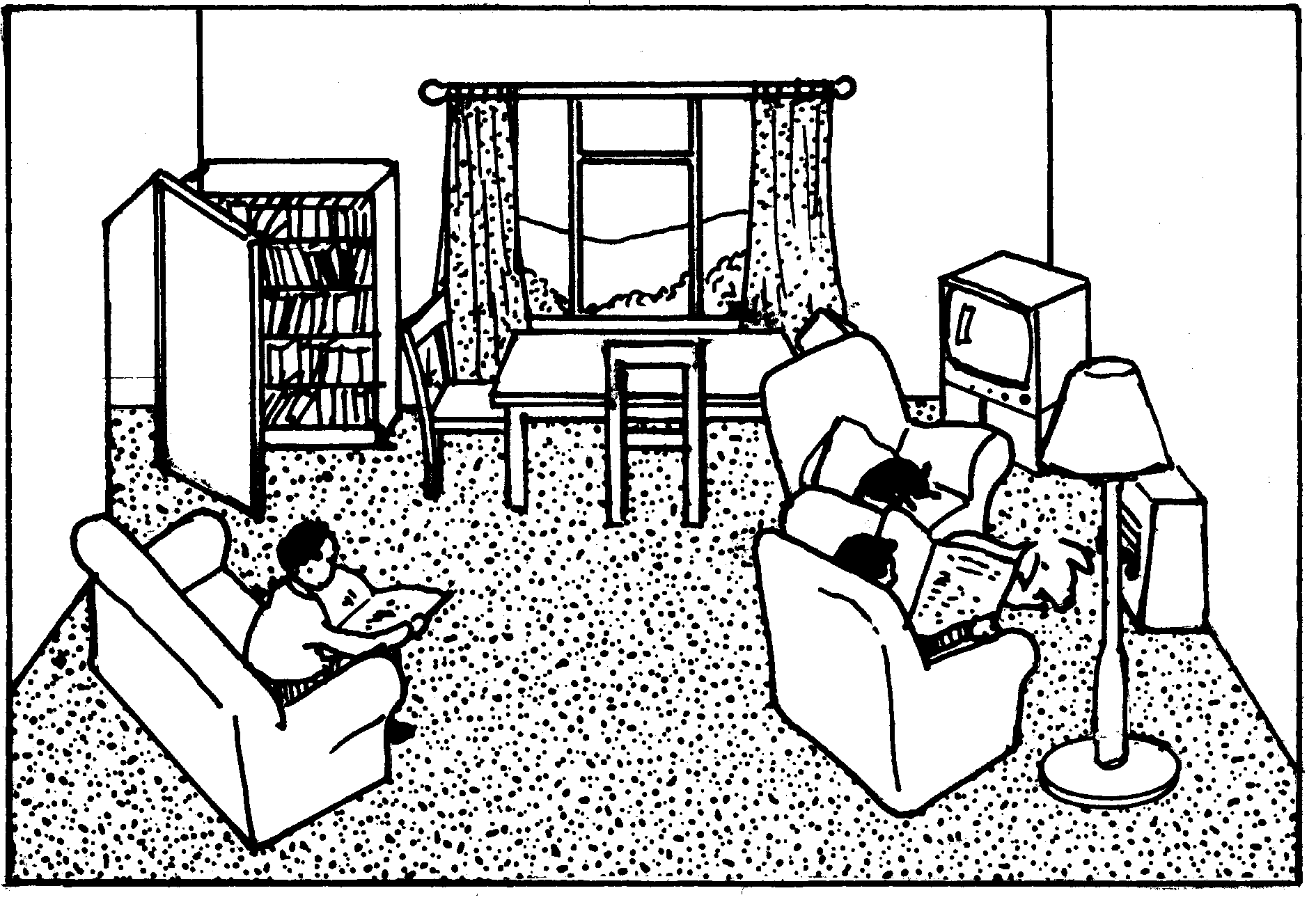
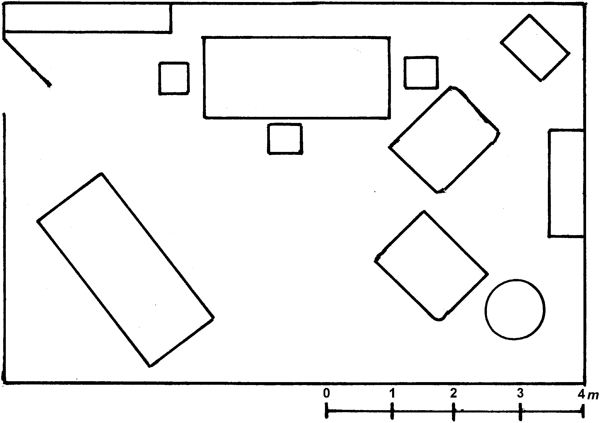
When you draw a plan or map of a room, the sheet of paper can’t be as big as the room. You must REDUCE the room on paper. To do that, you have to use a SCALE. Let’s take a look at Tom’s living room, and compare it with a plan or map of the same living room.

Tom’s living room

Map of Tom’s living room
In this map of Tom’s living room a line scale is used.
It means that on this map of Tom’s living room, one centimetre on the map is equal to one metre in real life.
The scales of different maps vary.
2. How to calculate distance with a line scale
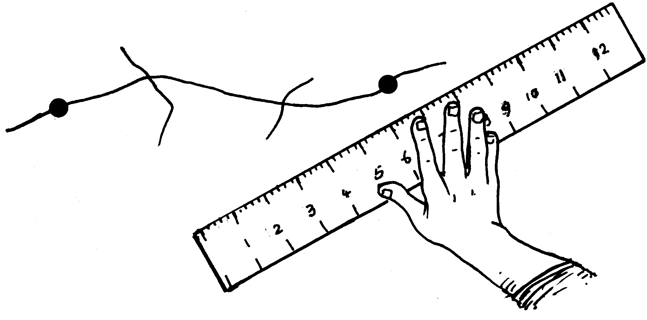
You measure the distance between two places accurately with a ruler or callipers on the map.

Then measure it directly on the line scale.
ACTIVITY:
TO USE A LINE SCALE
[LO 1.1]
1. What is the actual length of Tom’s sofa? m.
2. Study your atlas and then do the following distance calculations according to the line scale. (Measure as the crow flies – straight.)
How far is it from your town to the mouth of the Gariep River?
What is the distance from your town to Johannesburg?
Find Durban on the map. Suppose you live there and want to go to the following places: Pretoria, Cape Town, Bloemfontein
How many kilometres will you travel to each of them?
In which direction will you travel to each of them?
Fill in your answers in the open spaces.
| Distance in kilometres | Direction in which you’re moving | |
| Pretoria | ||
| Cape Town | ||
| Bloemfontein | ||
3. Ratio Scales
You also find RATIO SCALES on maps, e.g. 1 : 100 000. This means that the area on land is 100 000 times bigger than on the map. If you want to measure how far two places are from each other, you must do a calculation.
For example: Two places are 2 centimetres apart on a 1:50 000 map.
So 2 x 50 000 = 100 000 cm
= 1 km
Such a calculation can be difficult. So for our ends you’ll use the line scale for now.
IMPORTANT FACT!
Map scales help you to determine how far one place is from another.
Assessment
LO 1
GEOGRAPHICAL ENQUIRY
The learner will be able to use enquiry skills to investigate geographical and environmental concepts and processes.
We know this when the learner:
with guidance, selects and uses sources of useful geographical information (including graphs, maps and fieldwork outside the classroom) [finds sources];
categorises information [works with sources];
draws sketch maps and/or plans from field observation and measurements [works with sources];
uses an index to find places on global atlas maps [works with sources];
demonstrates knowledge and understanding of the issue through projects, discussion, debate and charts [communicates the answer].
Memorandum
3 m
| Distance in kilometres | Direction in which you’re moving | |
| Pretoria | ±500 km | NW |
| Cape Town | 1 300 km | SW |
| Bloemfontein | ±460 km | W |

Notification Switch
Would you like to follow the 'Social sciences: geography grade 5' conversation and receive update notifications?