| << Chapter < Page | Chapter >> Page > |
ACTIVITY 1:
TO IDENTIFY IMPORTANT PHYSICAL FEATURES ON A MAP
[LO 2.1]
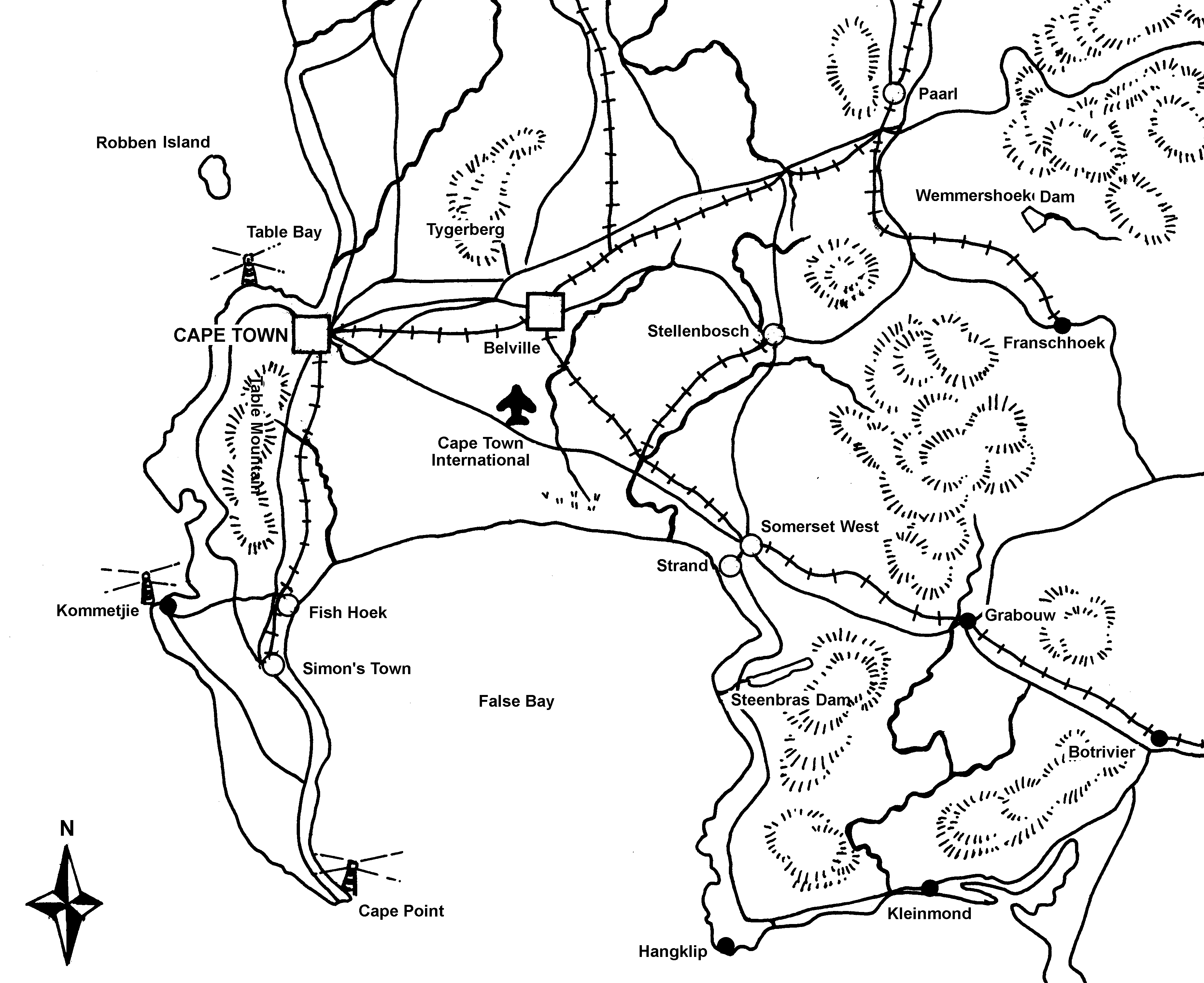
Study the map of the Cape Peninsula area below and then answer the questions that follow .
Provide a symbol key for this map below the map.
The Cape Peninsula Area
Du ToitskloofDiep River

If you live in another region, your teacher will give you a map of that region. Similar questions will then be asked about your own region.
ACTIVITY 2:
TO IDENTIFY IMPORTANT PHYSICAL FEATURES ON A MAP
[LO 2.1]
Your teacher will now hand out atlases and ask you to open them at the page with a map of the RSA. Using all your knowledge, answer the following questions and complete the accompanying map of the RSA:
- Give a reason for your answer:
and
- Where does the Gariep originate?
- In what direction does the Gariep flow?
- In what ocean does the Gariep discharge?
- Name the two most important branches of the Gariep.
and
- With what neighbouring countries does the Gariep River form a border?
and
Limpopo; Fish; Tugela.

LO 2
GEOGRAPHICAL KNOWLEDGE AND UNDERSTANDING
The learner will be able to demonstrate geographical and environmental knowledge and understanding.
We know this when the learner:
2.1 identifies and describes major physical features of South Africa, including those of the home province [people and places];
2.2 identifies links between natural resources and economic activities in South Africa [people and resources];
2.3 describes ways in which the physical environment influences human activity and how human activity is influenced by the physical environment [people and the environment].
ACTIVITY 1
ACTIVITY 2

Notification Switch
Would you like to follow the 'Social sciences: geography grade 5' conversation and receive update notifications?