| << Chapter < Page | Chapter >> Page > |
Related Resources
Alternative Names: Inbada; Imbadah; Imbâba; Ebaba
Latitude/Longitude: 30° 04' 00" N/ 031° 13' 00" E
A city in the Al Jīzah governate, and part of the greater Cairo metropolitan area.
Related Resources
Alternative Names: Al Ismā‘īlīyah; Ismailiyah; Ismailîya; Ismailieh; Al Ismā‘īlīya
Latitude/Longitude: 30° 35' 00" N/ 032° 16' 00" E

This site is unique in that it was built by the in the 19th century by the French engineer Lesseps as a base for the construction of theSuez Canal. Located on the Canal, halfway between Port Said and Suez, the city hadmany gardens and shady lanes that were severely damaged by the wars of 1956 and 1967. The Ismailia Museum contains many Greco-Roman artifacts, as well as itemsrelated to the building of the Suez Canal.
Related Resources
Latitude/Longitude: 30° 33' 00" N/ 032° 04' 00" E

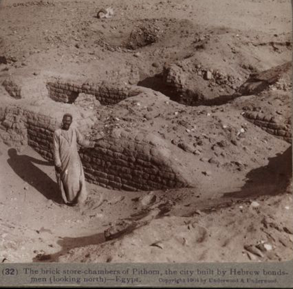
The location of Pithom was the subject of much discussion among Bible scholars, as it is mentioned in the Bible as one of the cities built bythe Israelites for the Egyptian Pharaoh. Its location was determined in 1883 by Édouard Naville. Located southwest of Ismailia in Lower Egypt, the main discoveries here were anumber of large honey-combed chambers, which most likely served as granaries for the Egyptian army.
Related Resources
Alternative Names: Būr Sa'īd; Madînet Port Said; Madînat Būr Sa'īd; Bor Sa'īd
Latitude/Longitude: 31° 16' 00" N/ 032° 18' 00" E

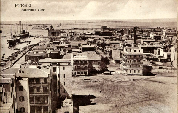
This city lacks any connection to Egypt’s ancient past; it is the expansion of what was originally a camp for men working on the Suez Canal.However, by the late 19th century it had become an important port city and was home to numerous consulates. In addition to the attractions of the port, where much ofthe world’s sea traffic waits to enter the Suez Canal, it is also home to a great deal of 19th century colonial architecture and several museums. Heavily damaged inthe wars of 1967 and 1973, it has been rebuilt and is today a very pleasant city of roughly 400,000.
Related Resources
Alternative Names: Rashīd; Rashîd; Rosette; Er-Rashid; Bolbitine
Latitude/Longitude: 31° 24' 16" N/ 030° 24' 59" E
This town is most closely associated with the finding of the Rosetta Stone, which was instrumental indeciphering ancient Egyptian hieroglyphics. However, its strategic location on the Rosetta arm of the Nile and the Mediterranean coast made it a very important sitefor military bases, even from predynastic eras, and it was of great interest to the Ottomans and other colonial powers. Although its fame is based on the Rosetta Stone,found in 1799 and now housed in the British Museum, today the town is a testament to the glories of Ottoman architecture. At least 22 houses of Ottoman design, alongwith several mosques and churches, were built with a unique brown brick and feature beautiful mashrabiyyas, the intricately carved window screens so characteristic ofNorth African architecture.
Related Resources
Alternative Names: Qanat as Suways; Qana el Suweis
Latitude/Longitude: 29.9166667 / longitude 32.55

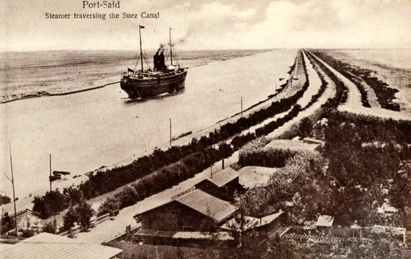
Linking the Mediterranean and the Red Sea, this feat of engineering opened in 1869. Although not the first canal (earlier ones, thoughnot exactly in the same location as the modern one, include ones built by Darius I and Trajan), the modern canal stretches over a hundred miles, from Port Said on theMediterranean to Suez and the Red Sea. Its opening was the cause of international celebration and was attended by royalty from all over the world; it was also markedby the opening of the “Old” Cairo Opera House, which has since been demolished.
Related Resources

Notification Switch
Would you like to follow the 'Places in egypt' conversation and receive update notifications?